
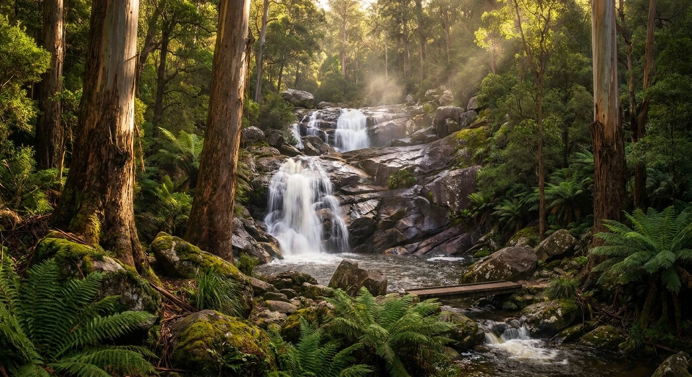
Exploring the Majestic Wilhelmina Falls
Tucked away in the dense, lush landscapes of Victoria, Australia, Wilhelmina Falls stands as one of the most remarkable natural attractions in the region. If you are looking for an invigorating outdoor experience that combines thick forest canopies, steep ascents, and the rewarding sight of cascading water, this destination delivers on every front. Nestled within the Murrindindi Scenic Reserve at the northern end of the Toolangi State Forest, the area provides a stunning escape from city life. Located roughly two hours drive north east of Melbourne, this spectacular geographical feature attracts nature enthusiasts, hikers, and photographers eager to witness the sheer power of mountain waterways.
What makes this specific waterfall so captivating is its dramatic geological formation. Unlike traditional plunge waterfalls that drop vertically off a sharp cliff, the water here cascades rapidly down an enormous, angled rock face. As you approach the viewing platforms, the roaring sound of water crashing against ancient stone echoes through the valley. It is an immersive natural environment where towering eucalyptus trees, dense fern gullies, and native Australian wildlife create a spectacular backdrop. The journey to reach the viewing area is just as significant as the destination itself, providing a thorough physical workout and a deep connection to the pristine Victorian High Country environment.
Read also: Explore Cathedral Rock Tasmania Safely; Window Jeannie Baker: A Visual Journey Through Time.
The Core Experience: Benefits, Challenges, and Trail Details
Embarking on the trek to this scenic reserve offers a multifaceted experience. The main route is widely regarded as a moderately challenging route, requiring a reasonable level of fitness due to the steep inclines and uneven terrain. However, the effort yields tremendous rewards. You get to witness a challenging trek with a stunning waterfall that perfectly balances physical exertion with scenic beauty.
The primary value proposition of this hike centers around three distinct benefits. First, it offers excellent cardiovascular conditioning; the steady climb gets the heart pumping and builds lower body strength. Second, the trail provides unparalleled opportunities for nature photography, with rich contrasts between the dark green ferns, pale grey granite, and rushing white water. Finally, the remote forest setting offers significant mental health benefits, allowing hikers to disconnect from digital distractions and immerse themselves in the calming atmosphere of the Australian bush.
To help you understand the trail dynamics, here is a detailed breakdown of the walking options available within the reserve:
| Trail Option | Distance | Estimated Time | Difficulty Level |
|---|---|---|---|
| Direct Return Walk | 6.3 km (Total) | 2 to 3 hours | Moderate with steep sections |
| Extended Loop (Boroondara Track) | Approx. 10 km | 3.5 to 4.5 hours | Challenging / Hard |
| River Walk (Base only) | 3 km (Total) | 1 to 1.5 hours | Easy / Flat |
To maximize your enjoyment and safety on the trail, proper preparation is essential. Here are three non-negotiable items you must bring:
- Sturdy Hiking Footwear: The trail features loose rocks, exposed tree roots, and steep, slippery sections, especially after rainfall. Proper ankle support and aggressive tread are vital.
- Adequate Hydration: Despite the shaded canopy, the steep ascent causes significant perspiration. Bring at least two liters of water per person.
- Weather-Appropriate Layers: The Victorian High Country is notorious for rapid weather changes. A breathable base layer combined with a packable rain jacket ensures comfort regardless of sudden shifts in temperature.
History and Origins of the Region
Geological Origins
The striking landscape of the Murrindindi Scenic Reserve is the result of immense geological forces operating over millions of years. The massive rock structures defining the waterfall began deep within the Earth’s crust as magma slowly cooled and crystallized into durable granite. Over successive geological eras, tectonic uplift raised this landmass, forming the rugged topography of the Great Dividing Range. Relentless erosion by wind and water gradually stripped away the softer sedimentary rocks covering the area, eventually exposing the hard, weather-resistant granite plutons that form the smooth, steep faces we see today.
Ecological Evolution
The Toolangi State Forest has undergone a complex ecological evolution. For millennia, this land has been shaped by the climate, rainfall patterns, and natural fire cycles. The ecosystem is dominated by the Mountain Ash (Eucalyptus regnans), which holds the title of the tallest flowering plant in the world. These towering giants rely on occasional bushfires for seed germination and canopy regeneration. The region has experienced severe wildfire events throughout its history, most notably the devastating 2009 Black Saturday bushfires, which heavily impacted the Murrindindi region. Since then, the forest has undergone a remarkable period of natural regeneration, with dense undergrowth and new eucalyptus saplings aggressively reclaiming the charred landscape.
Modern State and Conservation
Today, the reserve is carefully managed by environmental authorities to balance public access with conservation. Following the 2009 fires, significant infrastructure investments were made to restore trails, replace damaged pedestrian bridges, and construct safe steel viewing platforms. These modern additions allow visitors to safely observe the cascading waters without causing erosion or damaging fragile riparian zones. The area is now a thriving habitat once again, protected under state regulations to ensure the preservation of its native flora, fauna, and waterways for future generations to explore.
Scientific and Technical Deep Dive
The Geology of Smooth Granite Slabs
When observing the cascade, you will immediately notice the distinctive rock formation. The water does not drop vertically through the air; rather, it slides forcefully down an angled plane. This is due to a geological process known as exfoliation or “onion-skin” weathering. As the granite was uplifted and the overlying pressure was removed, the outer layers of the rock expanded and fractured in curved, sheet-like patterns. This peeling effect creates the massive, unblemished slabs that characterize the waterfall’s surface. Because granite is composed primarily of interlocking crystals of quartz, feldspar, and mica, it is incredibly resistant to the abrasive action of flowing water, which is why the rock face remains so structurally sound despite thousands of years of continuous liquid friction.
Hydrology and Catchment Dynamics
The volume and velocity of the waterfall are directly tied to the hydrology of the surrounding catchment area. As precipitation falls over the Toolangi State Forest, the dense canopy and deep forest litter act like a massive sponge, absorbing moisture and slowly releasing it into the network of alpine streams. This steady release feeds Falls Creek, which eventually reaches the dramatic drop-off. You can stand at the viewing platform and watch exactly how the water plunges down steep, smooth granite slabs before converging with the broader Murrindindi River system below. During the winter and spring months, peak rainfall and snowmelt from higher elevations significantly amplify the hydraulic pressure, creating a deafening roar as thousands of liters per minute rush over the stone.
- Vertical Drop: The site features a continuous flow that drops 75 metres in total elevation.
- Rock Composition: High-density igneous granite, highly resistant to fluvial erosion.
- Forest Type: Wet Sclerophyll forest, characterized by high moisture retention and towering canopy.
- Water Pathway: Originates from upland alpine rainfall, traveling through Falls Creek and terminating in the Murrindindi River.
Actionable Plan: The Ultimate Step-by-Step Hike Guide
Step 1: Preparation and Packing
Before leaving home, ensure you have packed appropriately for a remote forest environment. Download offline maps, as mobile reception in the Toolangi State Forest is highly unreliable. Pack a comprehensive first aid kit, high-energy snacks, and sufficient water. Check the local Parks Victoria website for any unexpected trail closures or weather warnings, as high winds can pose a risk of falling tree limbs.
Step 2: Navigating to the Trailhead
Drive towards the Murrindindi Scenic Reserve, accessed via the Melba Highway. Once inside the reserve, follow the unsealed forest roads to the designated parking area near the suspension bridge. Drive slowly and watch for wildlife, particularly wallabies and lyrebirds crossing the dirt roads. Park your vehicle securely and locate the large wooden information board to review the trail map one last time.
Step 3: Crossing the Suspension Bridge
The trek officially begins with a picturesque crossing over the Murrindindi River via a sturdy pedestrian suspension bridge. Take a moment here to enjoy the tranquil flow of the river below. This initial section is flat, well-maintained, and serves as an excellent warm-up for your leg muscles before the real physical exertion begins.
Step 4: The First Kilometre of the Trail
After crossing the river, the path gently winds through thick fern gullies and tall eucalyptus stands. According to official guides, completing the main route requires a 3.15km walk, 6.3km return in total. Use this first relatively flat kilometre to find a comfortable walking rhythm and regulate your breathing. Enjoy the shade and the distinctive scent of damp eucalyptus leaves.
Step 5: Tackling the Steep Ascents
Around the halfway mark, the elevation profile changes drastically. The trail begins to zig-zag up the side of the valley. This section features steep wooden steps and uneven rocky terrain. Pace yourself, take short breaks when your heart rate spikes, and use trekking poles if you require extra knee support. Keep your eyes on the path to avoid tripping over exposed roots.
Step 6: Arriving at the Viewing Platforms
Your hard work pays off as you hear the rushing water growing louder. You will arrive at a series of constructed steel platforms and staircases that cling to the side of the gorge. From here, you have an unobstructed, breathtaking view of the water tearing down the 75-metre granite face. Use this time to rest, rehydrate, and take photographs of the magnificent landscape.
Step 7: The Descent and Recovery
What goes up must come down. The descent can be particularly taxing on the knees and quadriceps. Take your time stepping down the steep stairs and rocky paths, as fatigue can lead to careless foot placement. Once back at the suspension bridge, do some gentle leg stretches. Enjoy a well-deserved snack by the river before driving back to civilization.
Myths and Reality
Myth: The trail is a flat, casual stroll suitable for everyone.
Reality: While the beginning of the track is relatively flat, the second half involves a strenuous, steep climb with numerous stairs and uneven surfaces, requiring a moderate level of physical fitness.
Myth: The waterfall flows with equal, thunderous intensity all year round.
Reality: The water volume is highly dependent on seasonal rainfall. It is spectacular in late winter and spring, but can reduce to a gentle trickle during the dry late-summer months.
Myth: You can swim at the base of the waterfall.
Reality: There is no safe swimming hole directly at the base. The steep, slippery granite and rapidly rushing water make attempting to access the rock face incredibly dangerous and strictly prohibited.
Myth: You need a heavy-duty 4WD vehicle to reach the parking area.
Reality: The unsealed roads within the reserve are generally well-graded and accessible by standard 2WD vehicles, provided you drive carefully to suit the conditions.
Frequently Asked Questions
Is there an entrance fee for Murrindindi Scenic Reserve?
No, there is currently no entrance fee required to visit the reserve or hike the trail, making it a fantastic budget-friendly outdoor activity.
Are dogs allowed on the trail?
Yes, dogs are permitted in the Murrindindi Scenic Reserve, but they must be kept on a leash at all times to protect native wildlife and ensure the safety of other hikers.
What is the best time of year to visit?
The optimal times to visit are during late winter and spring (August to November) when rainfall is highest, the rivers are flowing heavily, and native wildflowers are in bloom.
Can I camp near the waterfall?
While you cannot camp directly at the waterfall viewing area, the Murrindindi Scenic Reserve offers several excellent designated campgrounds along the river, equipped with fire pits and drop toilets.
Is the trail suitable for young children?
Due to the steep inclines and total distance, this hike is generally recommended for older children and teenagers who have previous hiking experience and good stamina.
Are there toilets at the trailhead?
Yes, basic drop toilets are available near the main parking areas and campgrounds, but there are no facilities once you begin the ascent up the trail.
Is there mobile phone reception in the reserve?
Mobile phone reception is extremely patchy and often completely unavailable in the valley and along the trail. Always download your maps and notify someone of your hiking plans beforehand.
Conclusion
Tackling the hike to Wilhelmina Falls is an unforgettable experience that perfectly showcases the rugged beauty of Victoria’s alpine environment. From the fascinating geological history of the smooth granite slabs to the intense physical reward of the steep ascent, every step of the journey is packed with natural wonder. Whether you are a dedicated photographer seeking the perfect landscape shot, or an avid hiker looking for your next weekend challenge, this trail deserves a spot at the top of your itinerary. Plan your trip, pack your sturdy hiking boots, and get ready to experience the power of nature firsthand. Share this guide with your hiking buddies and start organizing your next great outdoor adventure today!
Leave a Reply